Emphasizing on the need for surveying the land
Survey of a land is a crucial aspect to determine the three-dimensional position, the distance, and angles between them. All these are useful in developing a good piece of construction on the site. The professional engineers using the advanced tools provide effective land surveying that ensures complementary ownership. This survey provides knowledge about land their boundaries, positions and more to help them prevent any sort of land issue in the future.
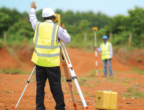
From the past history, surveying has been standing as an effective element for developing the human environment. The professionals using the latest devices such as total stations, robotic stations, theodolites, DPS receivers, retroreflectors, 3D scanners, digital levels, handheld tablets, radios, subsurface locators, drones, GIS, and surveying software for the proficiency of varying advanced technology.
Wide-ranging services of engineers
The civil engineers being educated and knowledgeable about the significance of land and other aspects, offer comprehensive service to their customers using the modern techniques and tools. Some of the quality services offered by experienced civil engineers involve designing and construction of transportation and infrastructure projects, sidewalks or footpaths, massive interstate freeways, and even more services within a periodic time to ensure the comprehensiveness of surveying. The experienced engineers are dedicated to offering reliable services ensuring safety.

The modern method of surveying the land
Gone those days when expert engineers have the high labor force to produce the data of land by manually surveying the property. In the early days, there was not much development of certain advanced tools that we are finding today. We are truly lucky to serve in present generation where an individual is getting benefitted with digital advancement.
Remote sensing and other sorts of satellite imagery are still continuing to be an effective tool. They are in high demand by the surveyors and have become cheaper to allow more compliance use to customers. Some of the more advanced techniques include three-dimensional (3D scanning), for a topographical survey they make use of lidar. Apart from this Ultraviolet technology with the photogrammetric image is also emerging as an effective type of equipment.


Comments
Post a Comment